


trou de la mouche

corynne
User
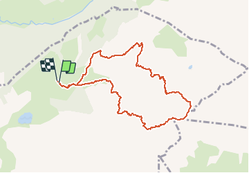

Length
9.6 km

Max alt
2440 m

Uphill gradient
1015 m
Km-Effort
23 km

Min alt
1441 m

Downhill gradient
1019 m
Boucle
Yes
Creation date :
2019-08-27 05:44:22.187
Updated on :
2019-08-27 10:10:51.738
4h23
Difficulty : Very easy

FREE GPS app for hiking
 SityTrail
IGN / Geographical institutes
SityTrail Plus
The world is yours!
About
Trail Walking of 9.6 km to be discovered at Auvergne-Rhône-Alpes, Upper Savoy, La Clusaz. This trail is proposed by corynne.
Photos

Positioning
Country:
France
Region :
Auvergne-Rhône-Alpes
Department/Province :
Upper Savoy
Municipality :
La Clusaz
Location:
Unknown
Start:(Dec)
Start:(UTM)
304936 ; 5088469 (32T) N.
Comments